(Click on figures and photos to enlarge)
The Northwest Branch of the Anacostia River is an urbanized stream in Montgomery and Prince George’s Counties, Maryland, draining 135.5 square kilometers at its confluence with the Northeast Branch of the Anacostia River. It straddles the Atlantic Fall Zone, which marks the transition from Coastal Plain sediment to crystalline Piedmont bedrock. In Mid-Atlantic streams the Fall Zone is present as a series of knickpoints migrating headward with post-Pleistocene sea level rise and glacial isostatic adjustment (Bierman, 2015; Pico et al., 2019). The active knickpoint in the Northwest Branch has propagated approximately 5 kilometers upstream of the Coastal Plain boundary into the portion of the river incised into Piedmont bedrock, at a site named Burnt Mills. There is approximately 20-40 meters of channel incision below the knickpoint. The river is incised into Piedmont alluvium upstream of Burnt Mills up to its head in Sandy Springs, MD.
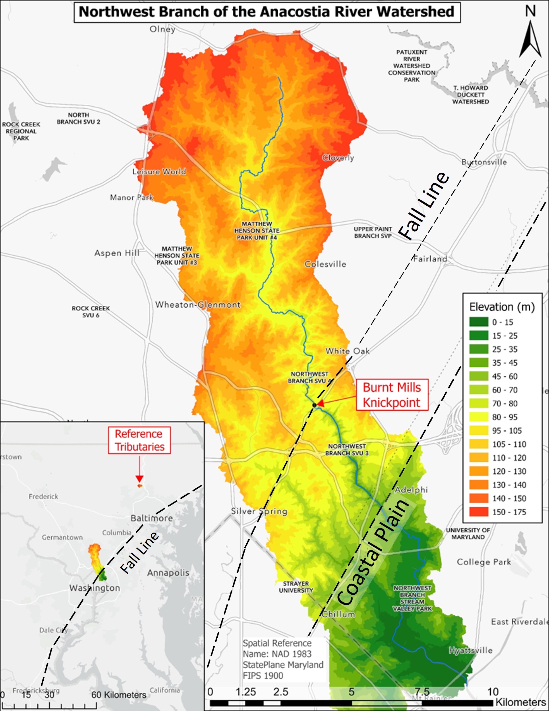
LiDAR-derived elevation map (Sanborn, 2021) of the Northwest Branch of the Anacostia River Watershed with the study reach and the knickpoint at Burnt Mills indicated. The Burnt Mills knickpoint is located along the Fall Line, which splits the watershed. The inset map shows the forested reference tributaries located above the Fall line in the Gunpowder River Basin in Baltimore County.
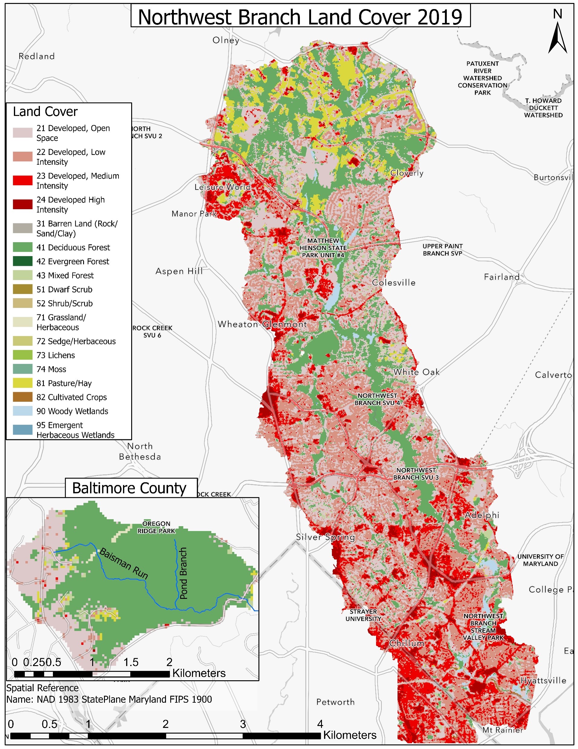
Land cover in the Northwest Branch and Baisman Run watersheds. Urban development in the watershed increases to the south towards Washington D.C. Land cover in the study reach is primarily low-medium intensity residential development in the upland portions and deciduous forest along the river. Baisman Run and Pond Branch watersheds are completely forested and undeveloped.
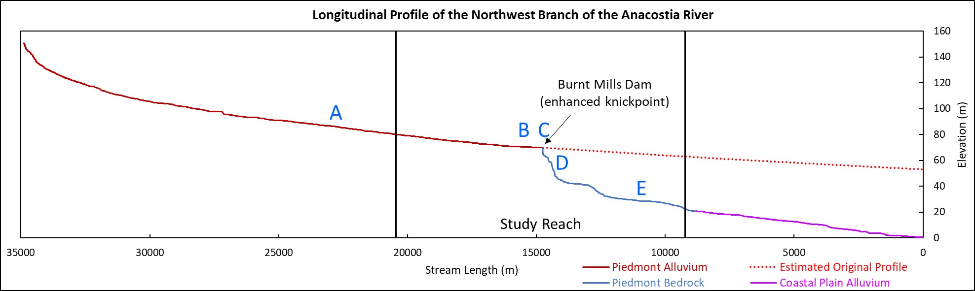
Longitudinal profile of the Northwest Branch from the drainage divide to the confluence with the Northeast Branch. The study reach, the Burnt Mills knickpoint (dam and torrent and gorge), and the three distinct geomorphic regions along the profile are indicated. An estimation of the longitudinal profile prior to knickpoint development is included. This estimation was created by projecting the stream length-gradient relationship in the Piedmont Alluvium region above the Burnt Mills knickpoint downstream to the mouth. Letters A-E mark the locations of photographs of the mainstem showing geomorphological changes.
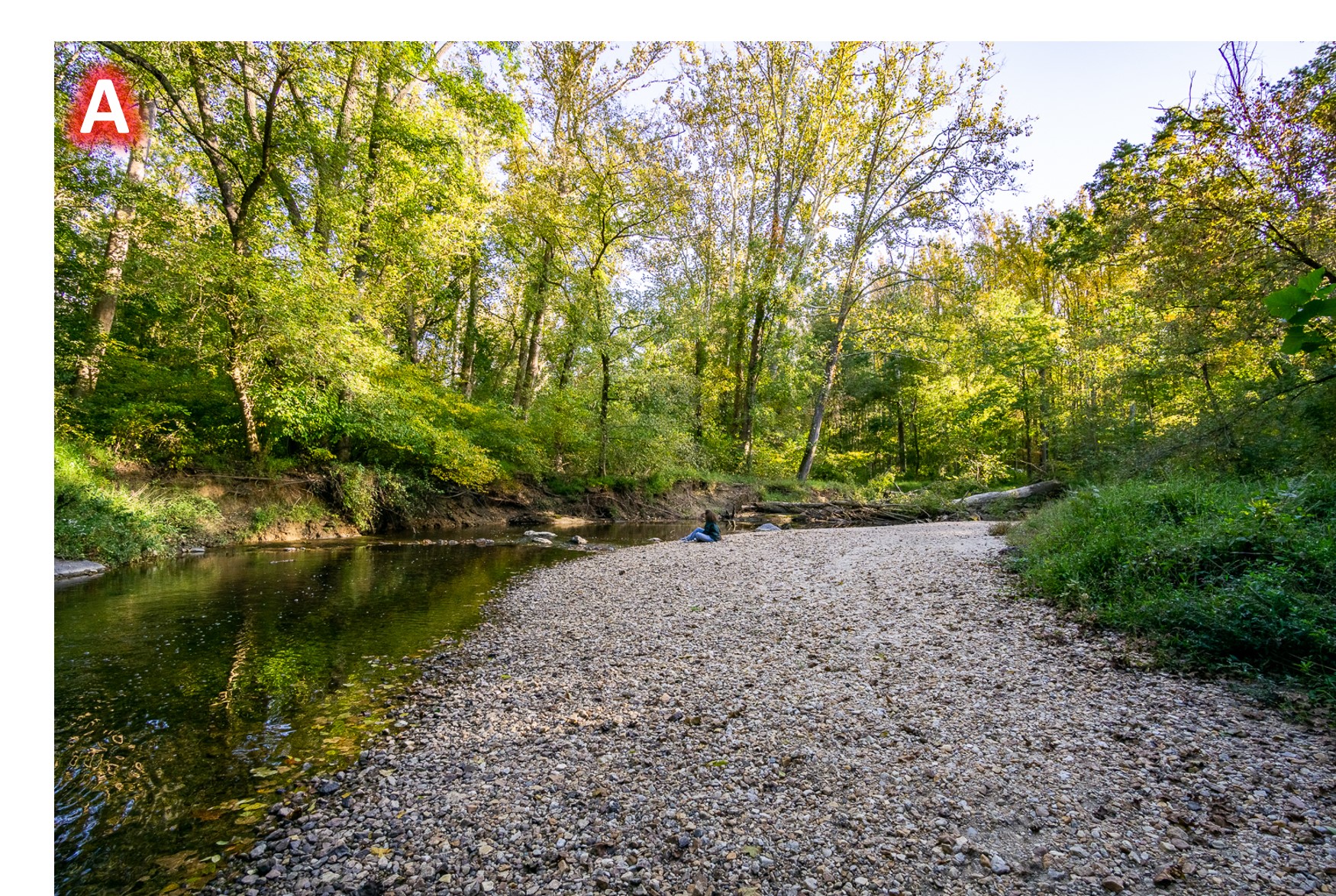
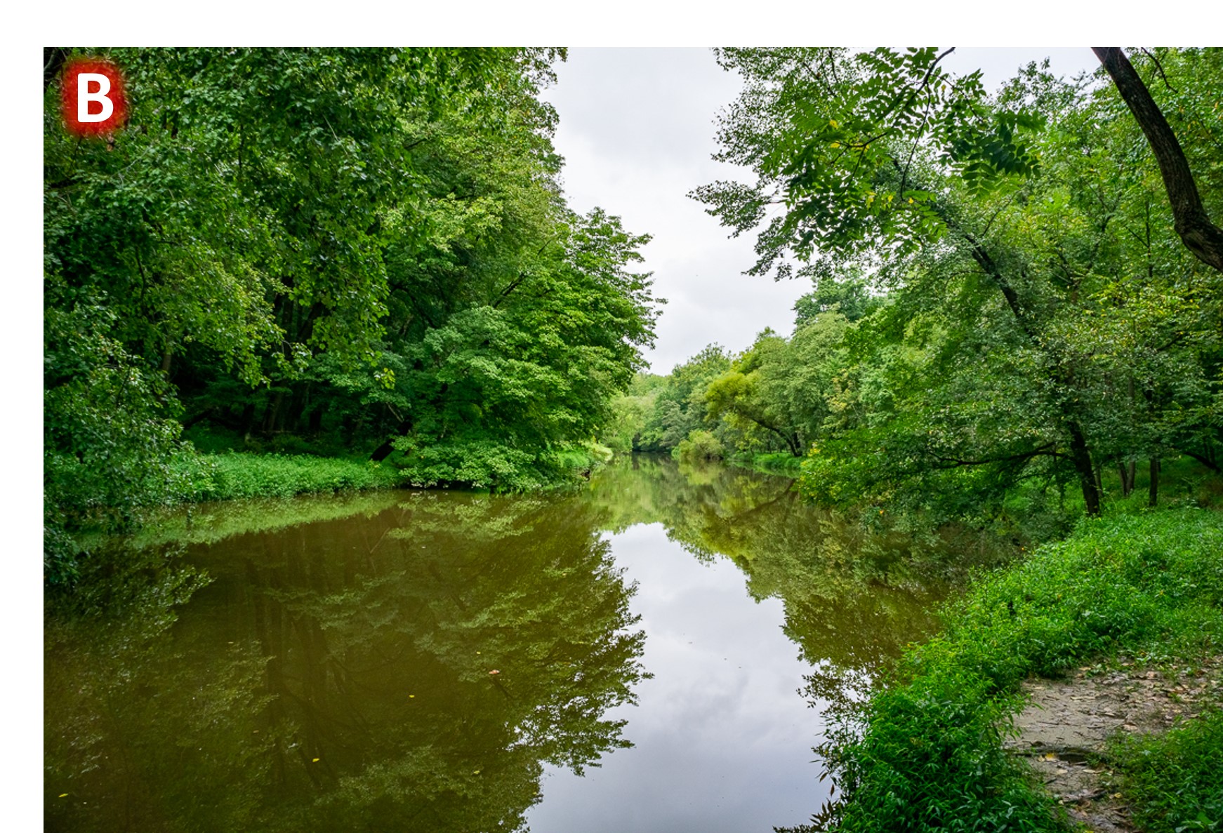
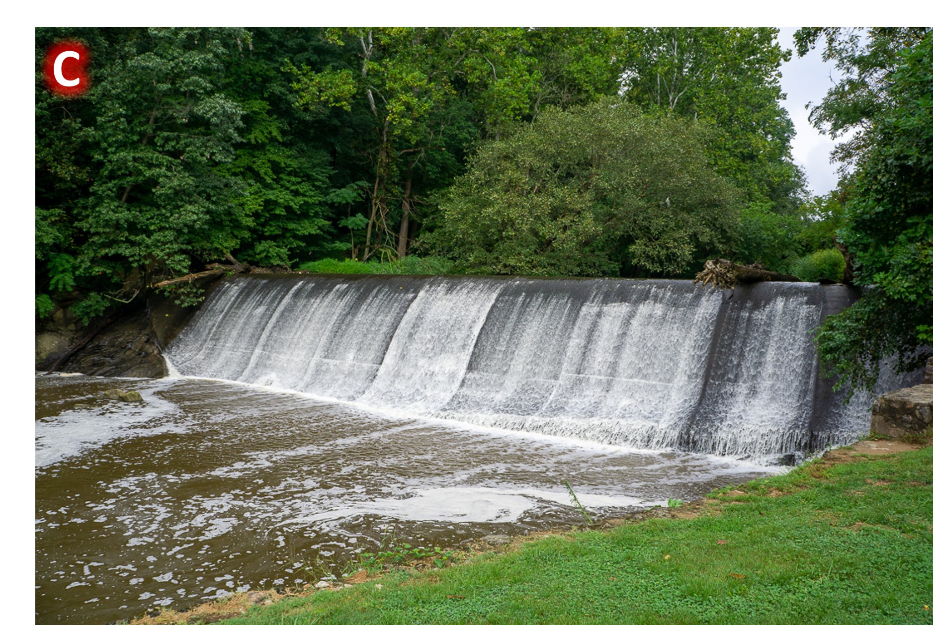

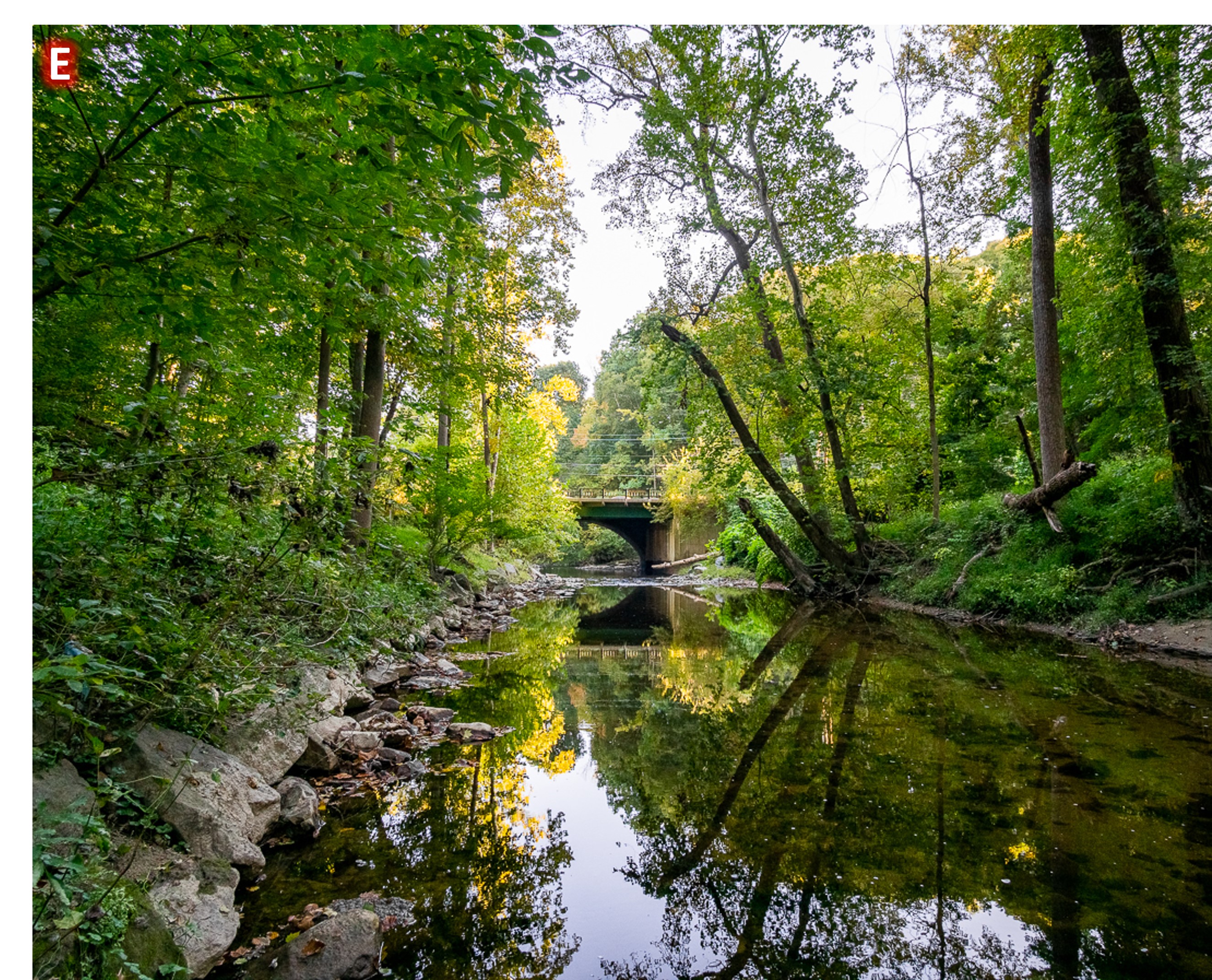
Photographs of the main stem. (A) shows the upstream portion of the main stem incised into the Piedmont Alluvium. The river here is meandering with a shallow gradient; a gravel point bar is shown. (B) shows the main stem directly above the Burnt Mills enhanced knickpoint. Stream flow here is impounded behind the concrete dam structure. (C) shows the Burnt Mills enhanced knickpoint. The concrete structure was built up approximately one meter above the existing bedrock knickpoint. (D) shows the Burnt Mills bedrock knick zone downstream of the enhanced knickpoint and Colesville Rd. (E) shows the main stem incised into the Piedmont Bedrock near the Coastal Plain transition.
The study reach consists of tributaries and their catchments that enter the channel above and below the active knickpoint. An examination of the spacing between tributary valleys indicates that tributary spacing decreases by over 50% below the knickpoint, suggesting active tributary formation due to channel incision, and perhaps more active hillslope erosion processes in a periglacial climate (Merritts & Rahnis, 2022).

Elevation profile parallel to the main stem along the eastern terrace showing the spacing between tributary valleys perpendicular to the main stem. The average distance between valleys above the knickpoint is more than twice the spacing between the valleys below the knickpoint. The valleys above the knickpoint also have greater average relief, showing that there are fewer but larger valleys above the knickpoint. As landscapes mature and approach dynamic equilibrium, convergence and stream piracy result in fewer but larger drainages. Convergent processes dominate over diffusive processes, resulting in increased concavity (Perron et al, 2008).
These small tributaries have also been affected by two major land use changes: Erosion and siltation associated with European settlement and agricultural practices, and urban runoff associated with post-WWII period urban development (Leopold, 1968). Construction activities have brought periods of high sediment loads into individual catchments and affected main stem sediment transport (Allmendinger et al., 2007).

Suburban-Era excavated sand deposited on top of legacy Agricultural-Era silt in the Coastal Plain portion of the Northwest Branch.
Suburban development is concentrated on the flatter ridge tops of these tributary catchments, which often convey runoff via stormwater channels to outfalls near the drainage divides. Our preliminary geophysical research indicates that this suburban development covers the thickest soil depths above the bedrock.
Heavily sediment-laden runoff from a construction site drained by a Northwest Branch tributary mixing into the mainstem following a summer storm.
The study reach includes tributaries with and without stormwater system contributions. Two tributaries in the Gunpowder River Basin in Baltimore County, MD are being studied as reference streams. These tributaries, Baisman Run and Pond Branch, are heavily forested and located above the Fall Zone. There is minimal suburban development in their catchments, none in the case of Pond Branch, and no stormwater system inputs. They are not influenced by knickpoint adjustment due to their position above the Fall Zone.
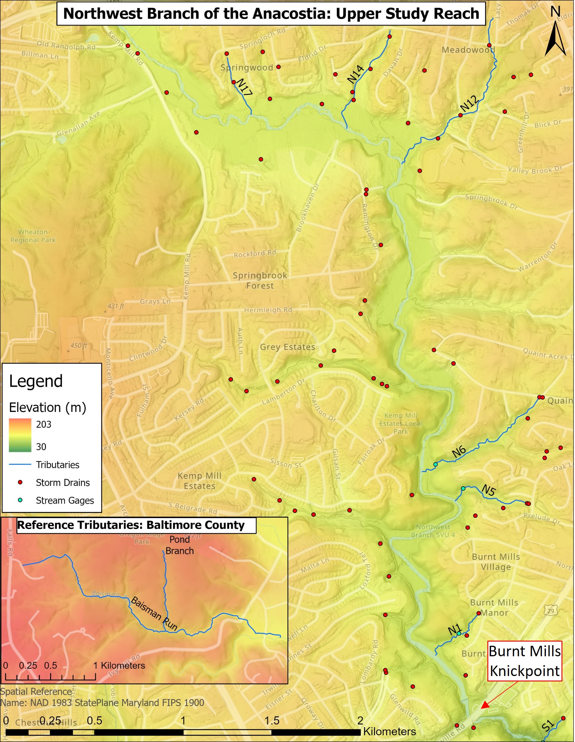
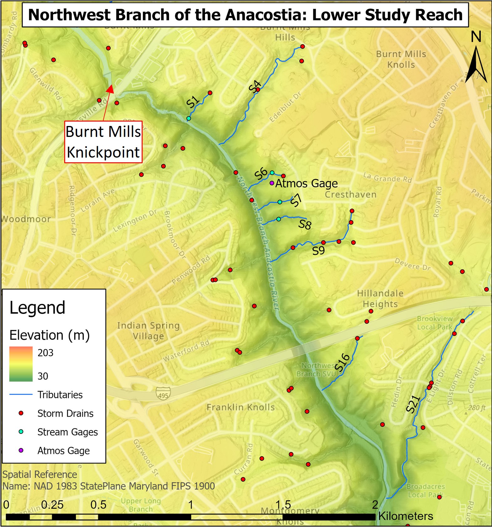
Map of the Northwest Branch study reach with the locations of the tributaries being studied, their stream gage locations, and storm drain outfalls. Tributaries S7 and S8 are the only tributaries not initiated by storm drain outfalls. The location of the atmospheric pressure gage used to correct the barometric pressure on the stream gages is also shown. The increased steepness of the hillslopes downstream of the knickpoint is evident with this elevation map. The forested reference tributaries in Baltimore County above the Fall Line are displayed in the inset map.
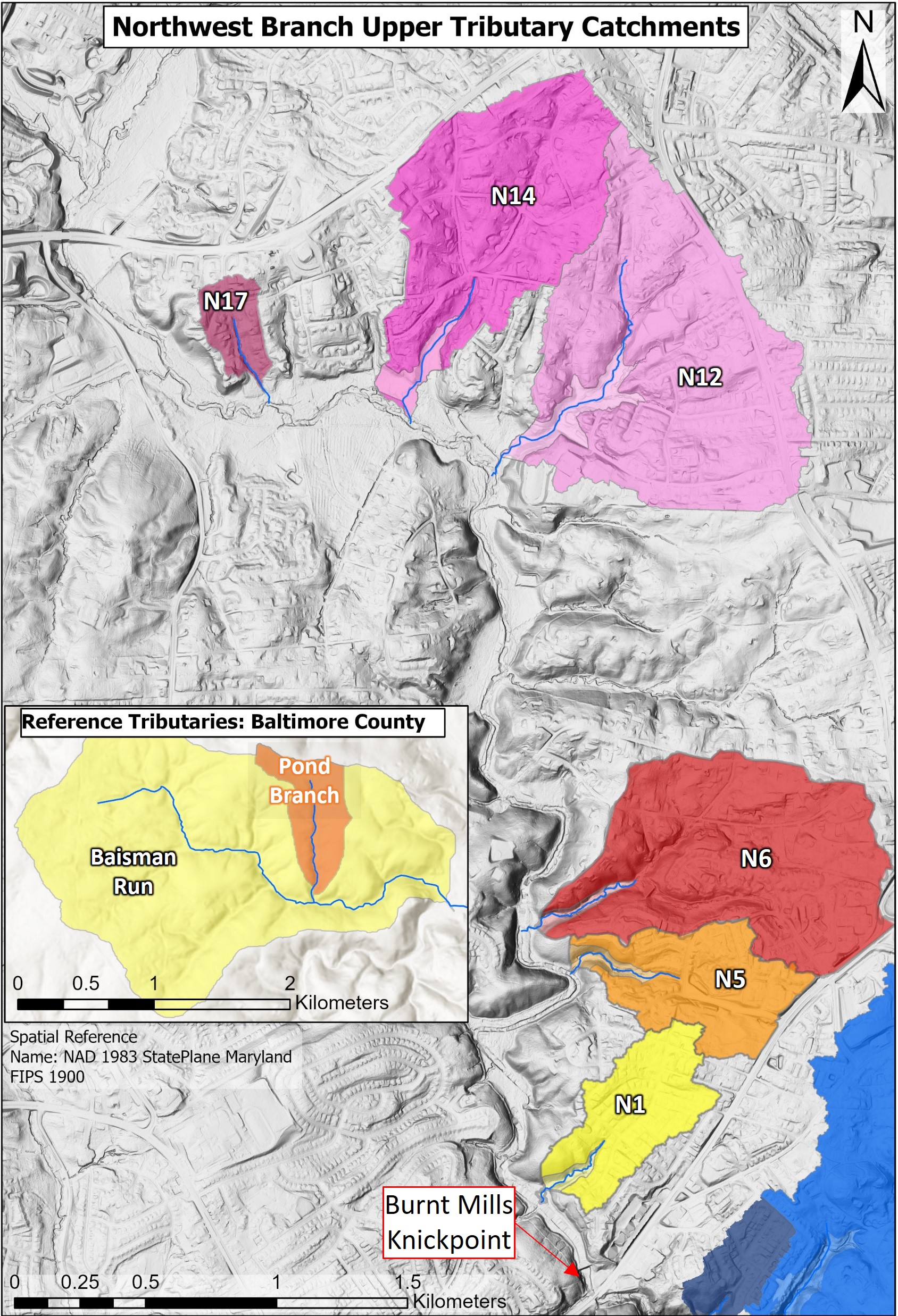

Map of the Northwest Branch tributary catchments being studied. The reference tributary catchments are shown in the inset map. The catchments were delineated using a LiDAR-derived digital elevation model analyzed with ArcGIS Hydrology tools. The catchments consist of primarily upland suburban development drained by stormwater systems, with forest cover on the hillslopes and valleys buffering the Northwest Branch. Catchments N1-N17 are above the Burnt Mills knickpoint, while Catchments S1-S21 are downstream of the knickpoint. “Type A” designates catchments of tributaries that appear to have been formed in response to knickpoint initiation. “Type B” designates those that appear to have existed prior to initiation of the knickpoint. The portions of the catchments incised into bedrock are indicated with lighter shades.
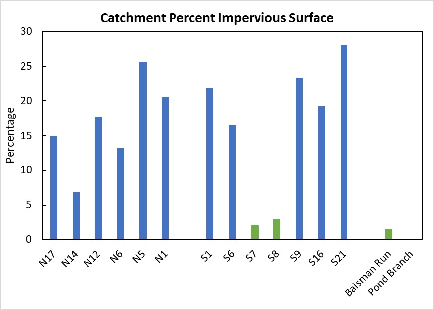
The percentage of impervious surface in each tributary catchment and the reference catchments. Catchments above and below the knickpoint show similar impervious cover except for S7 and S8, which do not have suburban development and stormwater systems. These plot with the undeveloped reference catchments.
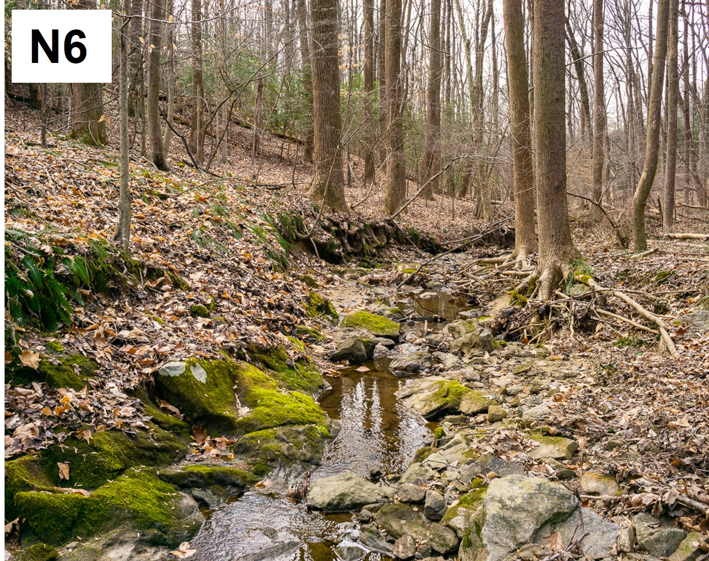

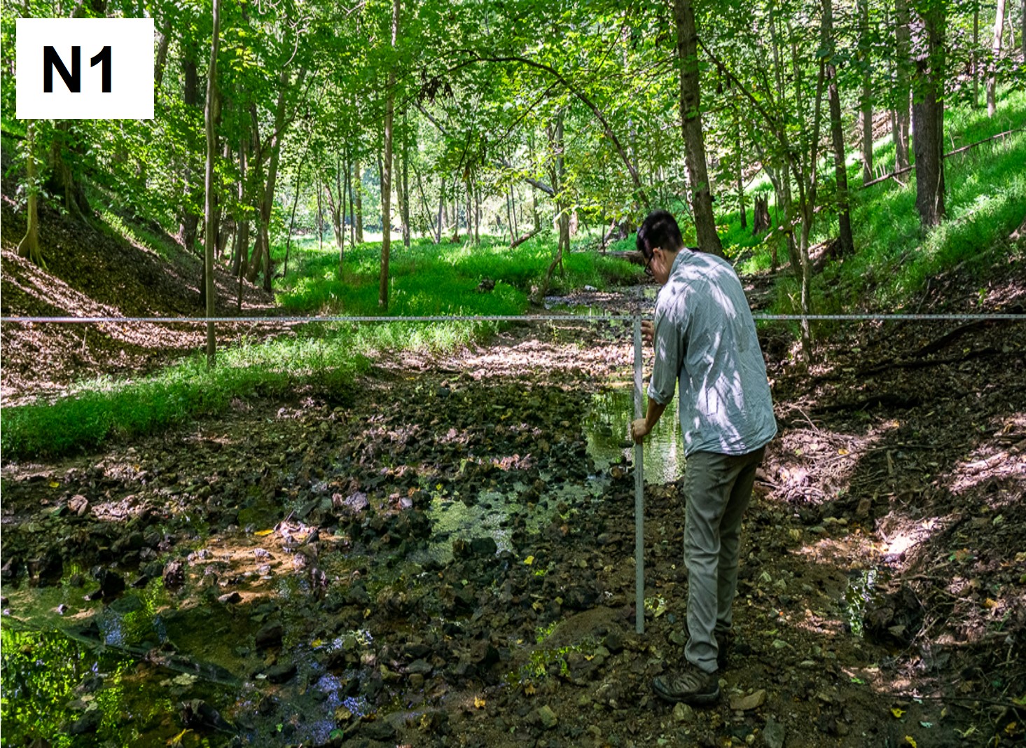
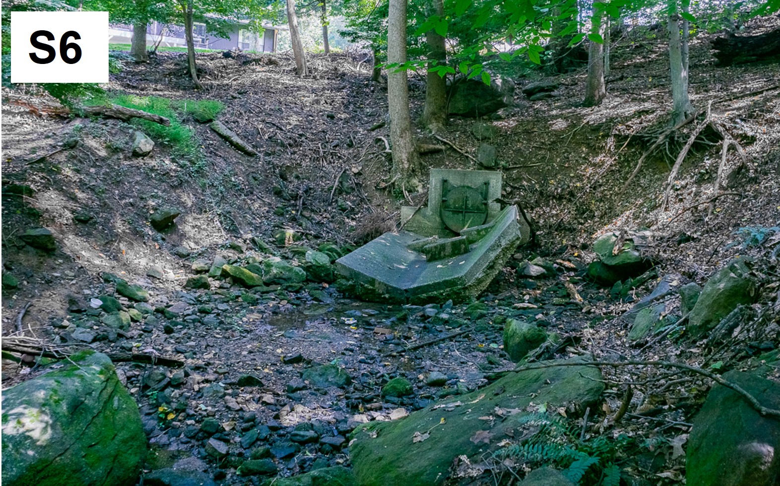
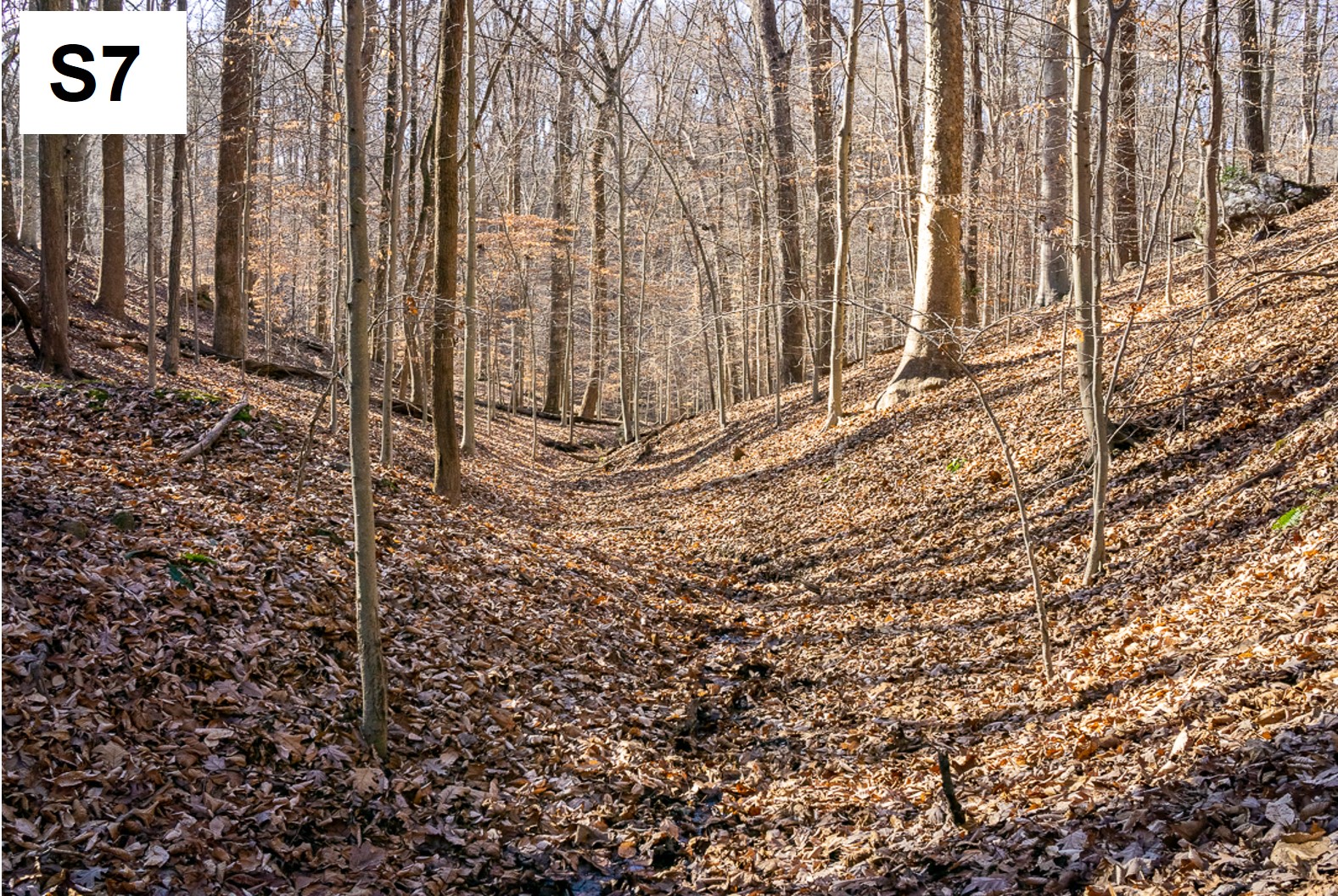
Representative photos of Northwest Branch tributaries being studied:
N6: Channel incised into the bedrock just downstream of the main storm drain outfall initiating the channel.
N5: Cut bank with approximately 10 meters of incision into the Agricultural-Era legacy silt.
N1: Channel with floodplain near the mouth, floodplains are not present in most downstream tributaries.
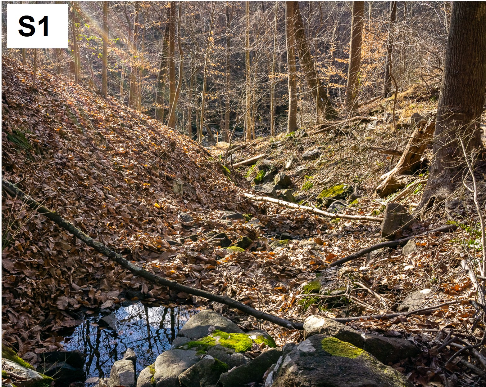
S1: Steep channel with step-pool morphology.
S6: Storm drain outfall at the channel head, note the significant headward erosion.
S7: Tributary without stormwater system contributions. Note the gentle V-shaped valley and leaves covering the channel. Baseflow and most stormflows are not able to mobilize the leaves in the channel, and instead flow under them.
